Physical Layer
The real-world City's infrastructure, including buildings, roads, bridges, and urban assets.

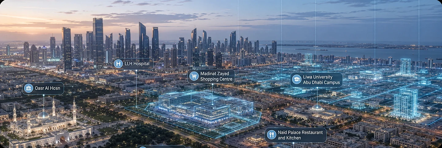
We built a digital twin platform for a leading urban development authority in the Middle East region, unifying GIS, IoT sensor data, and BIM models into a single Unreal Engine environment on AWS. Live infrastructure data updates the twin in near real time, giving planners a unified view of city infrastructure while improving incident response, maintenance, and cross-department visibility.


34%

27%
43%
A leading urban development authority set out to redefine how cities are planned, managed, and scaled by leveraging our digital twin development services. Their vision was to create a connected smart city where infrastructure, utilities, transportation, and public services could be monitored through a single, real-time digital ecosystem.
MaxLevels partnered as the digital twin engineering partner to build an enterprise-grade platform that integrated live operational data, IoT devices, GIS, and interactive 3D visualization. The solution enabled city stakeholders to monitor infrastructure, simulate urban scenarios, optimize resource utilization, and make faster, data-driven decisions for sustainable city growth.
 Integrate real-time city data
Visualize infrastructure in 3D
Monitor critical urban assets
Optimize city operations
Simulate planning scenarios
Support sustainable urban growth
Integrate real-time city data
Visualize infrastructure in 3D
Monitor critical urban assets
Optimize city operations
Simulate planning scenarios
Support sustainable urban growth
Before the platform, the authority's infrastructure, GIS, and operations data lived in disconnected departmental systems. Planners had no single, current view of the city, which made everyday decisions slower and higher-risk than they needed to be.
Live infrastructure, traffic and utility data existed across separate systems and dashboards. Operators had to piece together information manually, making it difficult to understand current conditions and respond quickly.
Planning teams worked with data across different systems, formats and coordinate references, creating additional effort to reconcile information before development decisions could be made.
Departments lacked a shared data layer, making cross-department collaboration dependent on manual requests and fragmented information.
Maintenance decisions relied heavily on scheduled inspections and historical information, limiting the ability to identify emerging issues and optimize resource use.
Stakeholders across departments had different tools, workflows and technical backgrounds, making it difficult to access and understand the same city data through a common interface.
The solution needed to accommodate additional districts, assets, sensors and data sources without requiring major changes to the underlying platform.
Six integrated capabilities that transformed fragmented urban systems into a real-time operational intelligence platform.
The pilot district was modeled in Unreal Engine 5, covering roads, buildings, utilities, and public assets. Connected to live sensor data, the twin reflects the current state of the physical city and refreshes within 5 seconds of new data arriving.
Cadastral surveys, zoning maps, topography, GNSS positioning, and LiDAR data were brought into one coordinate system using QGIS. The resulting 3D data was streamed into Unreal Engine through Cesium, creating a consistent geospatial foundation for planners.
Transportation, utilities, environmental monitoring, and public service systems were connected through authenticated APIs. This created a shared, up to date view of city operations across departments.
A time series forecasting model analyzed maintenance and sensor history to identify infrastructure at increasing risk of failure, giving maintenance teams a two week look ahead instead of relying only on fixed inspection schedules.
Pixel Streaming runs the 3D environment on AWS and delivers it through the browser. Authorized users can explore the live twin, switch between operational layers, and access city data without specialist GIS software.
The platform runs on AWS with containerized services, managed sensor data ingestion, and autoscaled GPU resources for Pixel Streaming. The architecture supports new districts and data sources without requiring a complete rebuild.
Data moves from physical infrastructure through ingestion and processing into the twin, then out to the people who need it.
 Cadastral surveys & zoning
maps
IoT sensors & telemetry
IFC / BIM models LiDAR point clouds
Cadastral surveys & zoning
maps
IoT sensors & telemetry
IFC / BIM models LiDAR point clouds QGIS reprojection & cleanup
Streaming Ingest for
telemetry
3D Tiles publishing (Cesium
ion)
QGIS reprojection & cleanup
Streaming Ingest for
telemetry
3D Tiles publishing (Cesium
ion)
 Unreal Engine 5 environment
Cesium for Unreal geospatial
layer
Time-series data store
Unreal Engine 5 environment
Cesium for Unreal geospatial
layer
Time-series data store Pixel Streaming (browser,
WebRTC)
Operational dashboards Role-based APIs
Pixel Streaming (browser,
WebRTC)
Operational dashboards Role-based APIs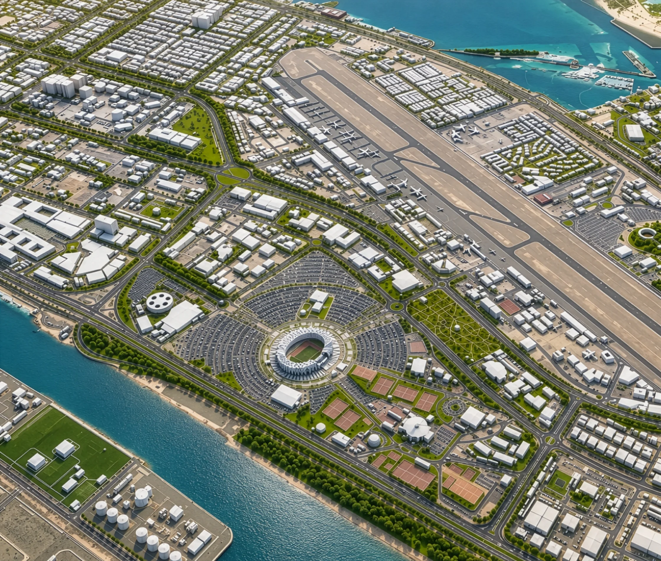

The real-world City's infrastructure, including buildings, roads, bridges, and urban assets.
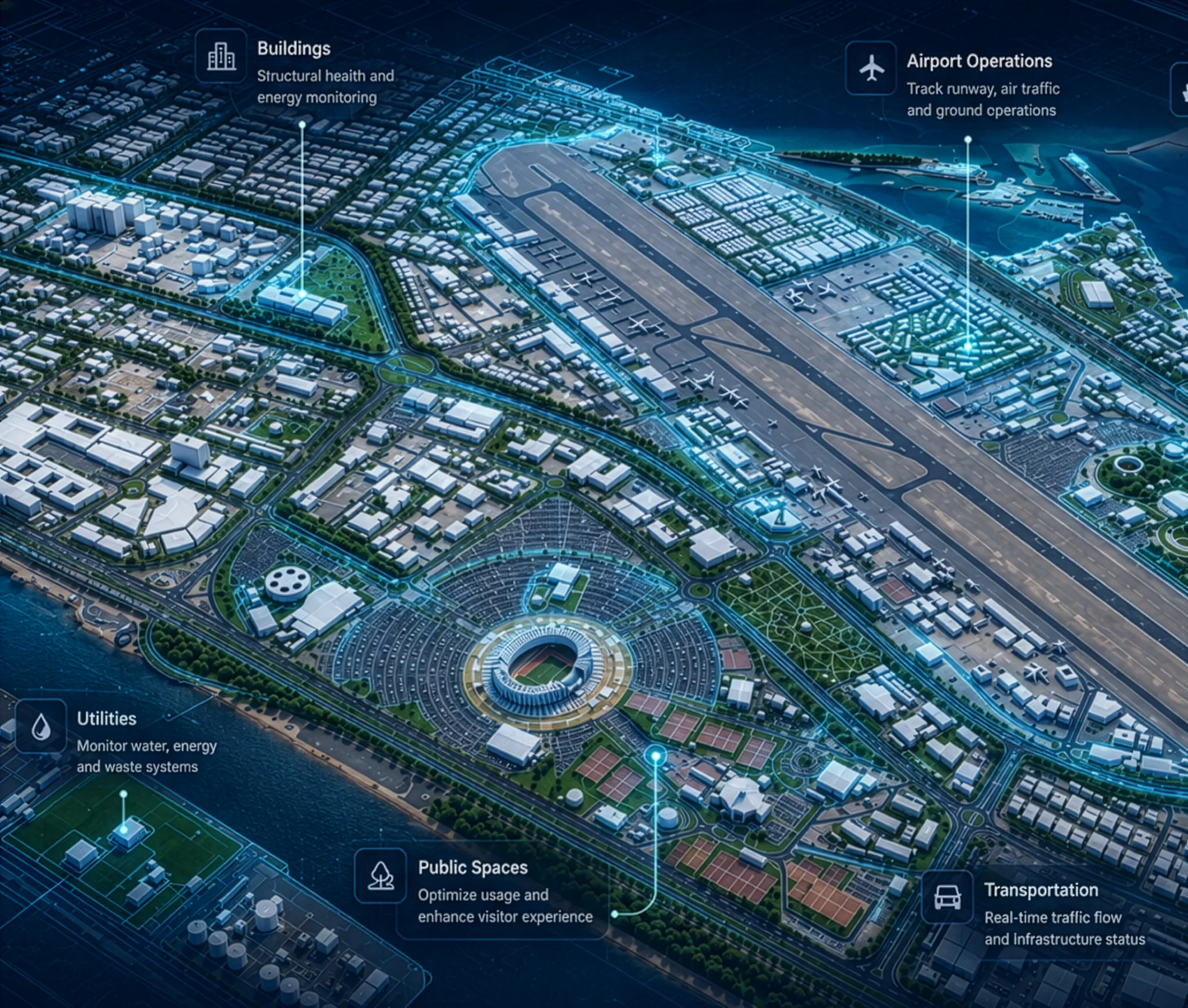

A dynamic virtual replica of the city that mirrors its physical structure and behaviour.
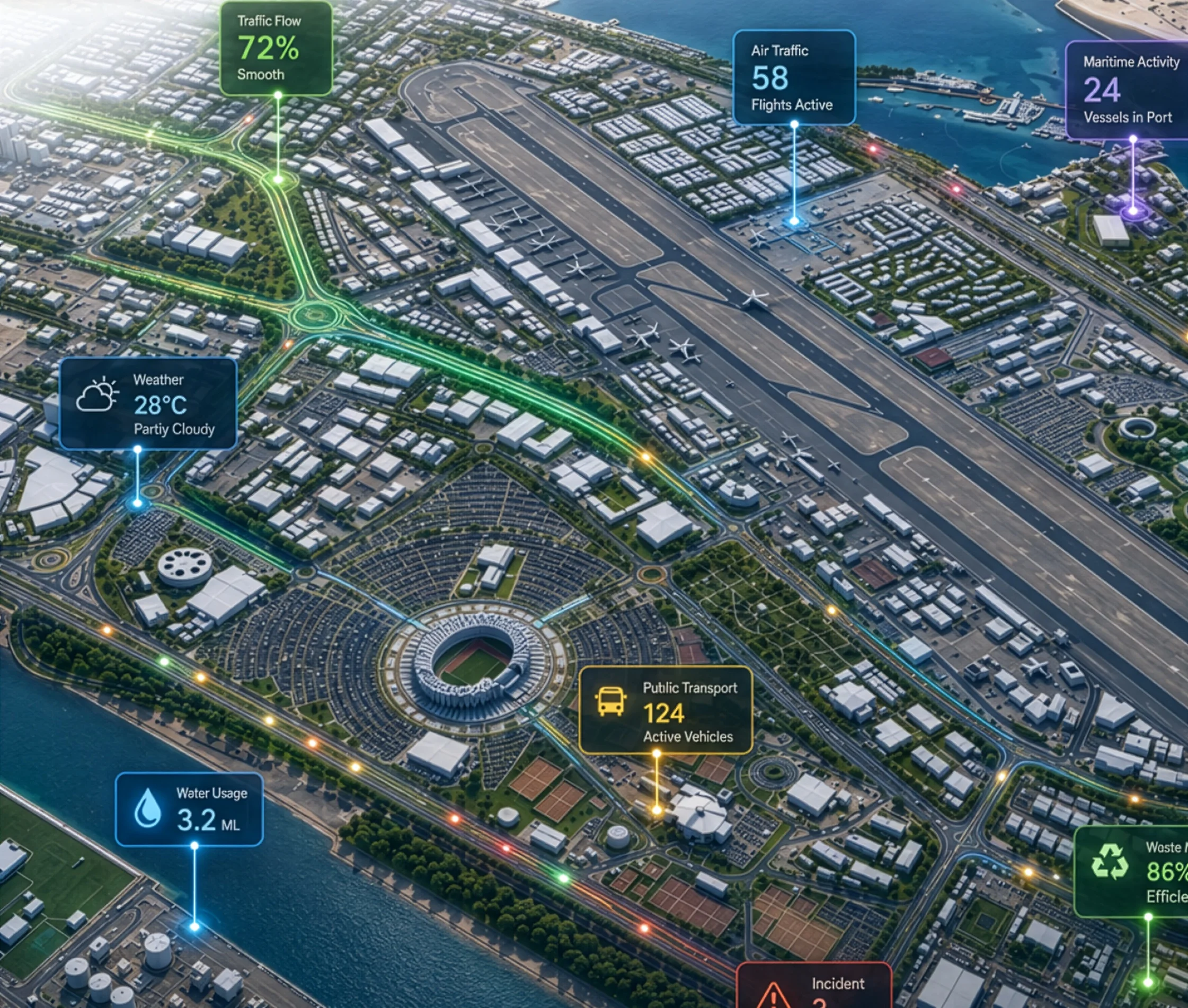

Real-time data streams from sensors and system that power insights and decisions.
Grouped by the job each technology does, not just a list of names.
A multidisciplinary team partnered with the authority’s digital transformation office to deliver the platform from discovery through pilot deployment.

Across Unreal Engine, GIS/geospatial engineering, backend and data engineering, machine learning, and DevOps.

From discovery through pilot go-live for the pilot district.

MaxLevels owned platform engineering end-to-end — geospatial pipeline, Unreal Engine environment, cloud infrastructure, and the forecasting model. The authority's IT team managed network access, data governance, and rollout decisions.

An embedded delivery team working directly with the authority's digital transformation office.
Every outcomes below reflects the twelve months after go-live, compared with the same window beforehand, measured from the authority's incident logs, maintenance records, and platform usage data.
Real-time monitoring and immersive 3D visualization helped optimize traffic, energy, and public services, improving operational efficiency while reducing manual intervention.

AI-powered analytics transformed live urban data into actionable insights, enabling faster planning, proactive infrastructure management, and informed policy decisions.
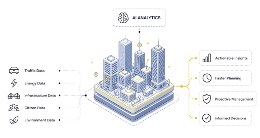
Pixel Streaming made the digital twin accessible across devices, increasing transparency, encouraging cross-department participation, and strengthening collaboration between city authorities & citizens.
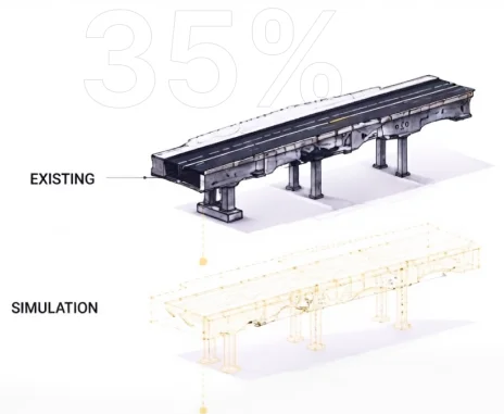
Interactive simulations and real-time operational insights accelerated planning and decision-making by 35%, enabling faster infrastructure development and more efficient resource allocation.
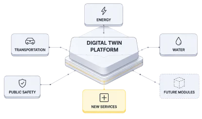
A cloud-native, modular architecture enabled the platform to scale seamlessly as the city expanded, supporting new services, connected assets, and future technologies.
Sensor telemetry streams into a managed ingest service on AWS, where readings are normalised to a common schema and matched to asset identifiers so data from separate departmental systems resolves against the same infrastructure records. Current values update the Unreal Engine environment within five seconds of arriving, while history is written to a time series store for trend analysis and forecasting.
Yes, and it is a deliberate trade-off. A game engine gives real-time rendering quality and interaction that traditional GIS platforms do not, which matters when planners are exploring scenarios rather than reading maps. It is not a GIS system of record, so geospatial accuracy comes from the source data pipeline. On this platform Unreal Engine 5 handles the environment, with Cesium for Unreal providing the georeferenced base.
The two use different coordinate systems, different levels of detail and different update cycles, so reconciliation happens before anything reaches the twin. Cadastral surveys, zoning, topography and GNSS positioning are reprojected to a single coordinate reference system in QGIS. BIM geometry is simplified against a runtime performance budget, then both are published as 3D Tiles and streamed into Unreal Engine through Cesium.
Yes. The pipeline consumes standard geospatial formats, so ArcGIS layers, file geodatabases, shapefiles and OGC services such as WFS and WMS can feed the twin alongside other sources. QGIS is used as a preparation and reprojection step, not as a replacement for an authority's existing GIS system of record, which stays where it is.
Pixel Streaming renders the environment on GPU instances in AWS and delivers it to a standard browser over WebRTC, so no local installation or dedicated graphics hardware is needed. Each concurrent 3D session occupies a GPU instance, so capacity is managed through autoscaling with session pooling and idle timeouts. Dashboard and API users do not consume streaming sessions.
Cadastral and topographic survey data is the practical minimum, since it establishes the geospatial foundation everything else attaches to. BIM models, LiDAR point clouds and IoT sensor coverage improve fidelity and can be added incrementally after go-live. Most authorities begin with gaps, and discovery exists to map them, so incomplete coverage delays scope rather than blocking the build.
This platform took 12 months from discovery through pilot go-live for the first district. The largest variable is source data readiness. Where surveys, BIM models and sensor coverage already exist in usable, current form, delivery moves faster. Where data has to be recaptured or cleaned first, that work runs in parallel and adds to the front of the schedule.
That is how this platform was delivered. The pilot district established the geospatial pipeline, the data integrations, the deployment pattern and the performance budget. Additional districts reuse that foundation, making expansion largely a data onboarding exercise rather than a rebuild. Phasing this way also lets an authority validate the operational value before committing to city-wide coverage.